

INNOVATIVE APPROACH
GeoProfessional offers a fresh new approach to classical methods for ground and underground shallow surveying.
The majority of GeoProfessional Services are non-invasive making them favorable candidates for projects in Real Estate, Construction, Archaeology, Environmental.
By using methods that are cost-effective, fast and reliable, GeoProfessional represents an accessible solution for gaining the upper hand in a highly competitive market.
Gallery

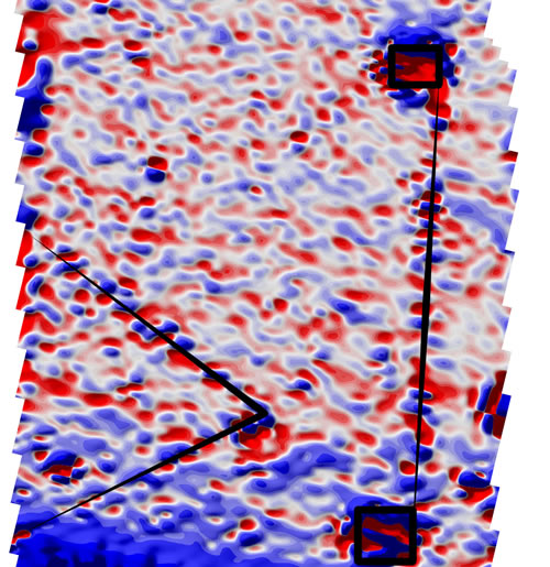
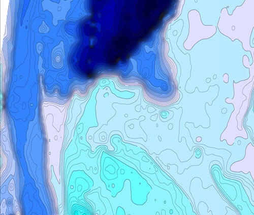
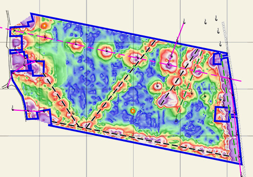
GeoScan - Detecting, Scanning, Mapping
|
GeoTechnic – Surveying Underground Characteristics
|
GeoTopo – Topographic Surveying Services
|
GeoEco – Environmental Studies and Services
|
Survey Methods
![]() GPR (Ground Penetrating Radar) – non-invasive geophysical survey used for mapping and delineating: pipes, live wires and sewers underneath asphalt or concrete cover
GPR (Ground Penetrating Radar) – non-invasive geophysical survey used for mapping and delineating: pipes, live wires and sewers underneath asphalt or concrete cover
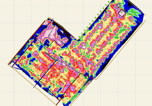
![]() Ground Magnetic Survey (± gradient) – versatile non-invasive geophysical survey used for mapping and delineating: pipes, live wires and sewers, foundations, waste dumps
Ground Magnetic Survey (± gradient) – versatile non-invasive geophysical survey used for mapping and delineating: pipes, live wires and sewers, foundations, waste dumps
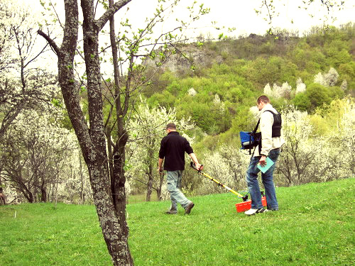
![]() Electric Survey – versatile non-invasive geophysical survey used for detecting and mapping: pipes, live wires, underground cavities, polluted areas, waste dumps, buried walls, foundations and lithology
Electric Survey – versatile non-invasive geophysical survey used for detecting and mapping: pipes, live wires, underground cavities, polluted areas, waste dumps, buried walls, foundations and lithology
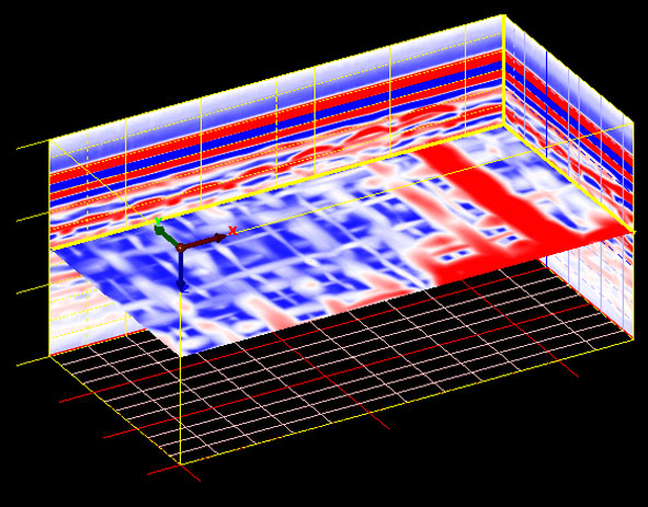
![]() Seismic Refraction and MASW – non-invasive geophysical survey used for detecting and delineating: underground lithology, depth to bedrock, foundation conditions
Seismic Refraction and MASW – non-invasive geophysical survey used for detecting and delineating: underground lithology, depth to bedrock, foundation conditions
![]() Radiometry and Spectrometry – non-invasive geophysical survey used for potential radioactive hazard assessment and indirect pollution and lithological information
Radiometry and Spectrometry – non-invasive geophysical survey used for potential radioactive hazard assessment and indirect pollution and lithological information